
Secteur 1, 2 et 3: Alcoutim - Vaqueiros
Le Algarviana Via commence à Alcoutim à côté de la jetée. Dans les 3 premiers secteurs, vous pouvez voir:
Culture:
- Château de Alcoutim
- Château Vieux de Alcoutim
- Musée archéologique de Alcoutim
- Monument megalitic Menhir de Lavajo (3500 avant JC).
- Alcoutim église principale
- Musée religieux à l'église Nossa sr ª da Conceição- Sto Antonio Chapelle
- Dolmen Malhão dans Afonso Vicente Village
- Église de Odeleite
- Four à bois traditionnel
- vieille Mines de cuivre de Furnazinhas
- Usines Furnazinhas vieux vent
- Caractéristiques agricoles traditionnelles (terrasses agricoles, vieux puits, roue à eau)
- Vaqueiros principale église
- S. Bento chapelle en Alcaria Queimada
- Cova dos Mouros parc minier
- Parra Fontaine
Nature:
- Site Natura 2000 "Guadiana", Habitat spéciale pour les espèces menacées et les poissons endémiques telles que le "Saramugo" ou "Boca-do-Guadiana"
- Les oiseaux d'intérêt: l'Aigle de Bonelli, Eagle Owl, Loriot d'Europe, à croupion rouge-Avale, Blue-winged-Magpie, roux Bush Robin, Pie-grièche-Eagle, Dartford Warber, Rock Bunting, Loriot et Bee Eater
- Zone spéciale pour la loutre et plusieurs espèces de chauves souris
- La rivière de Foupana et sa végétation dense
- La rivière de Odeleite
- Cork et chênes forêt
- Une riche faune de la diversité, y compris le sanglier, le renard roux, la loutre, entre autres
- Les petits ruisseaux avec divers fluviales flore
Repos et les zones snack long de la route:
- Snack-Bar "Tempero" à Cortes Pereiras
- Centre Culturel Afonso Vicente
- Snack-bar "Ti Emídio" dans Corte Velha
- Association de la Solidarité sociale, Culture, Sport et Art de Balurcos
- Café Nikko
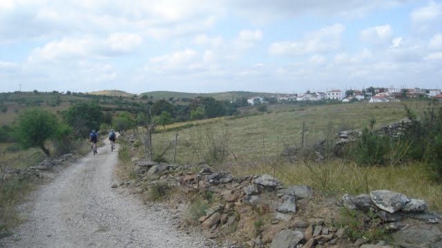
Stage Images:


Resümee techniques:
Distance: 58,8 Km
Difficulté: Moyenne
Hauteur maximale: 301 m
Disponibilité de l'eau: Oui
Alimentation: Oui
Hauteur graphique:

Étape 1 Carte:

Secteur 4, 5 et 6: Vaqueiros - Salir -Salir
A ce stade, vous pouvez voir:
Culture:
- Santo Estevão église de Cachopo
- Maisons ancestrales de ferme
- Vieux moulins à vent
- Four traditionnel pain bois
- Musée de Cachopo
- Dolmen de Mealha
- Dolmen de Alcaria Pedro Guerreiro
- Barranco do Velho église
- Traditionnelle maison de les travailleurs de la route
- moulin à vent de Faranhão ( ou Eira dos Agostos)
- Les réservoirs d'irrigation et fontaines anciennes pour l'agriculture
- Vieille fontaine à Barranco do Velho
- Cork production
- Querença Water Museum
- Diverse Hidraulic patrimony, including old irrigation tanks, waterwheels, water mills, old irrigation channels
- Rio Seco Windmill
- Querença Main church
- Salir main church
- Salir Castle
- Salir Museum
Nature:
- Mediterranean vegetation, including dense cork forest and several arbustive species(Strawberry tree, tree heath, Gum Rockrose, Mashrooms)
- Rich fauna, with special species namely the Bonelli's Eagle, Eagle Owl, Wild Cat, Iberian chiffchaff among Others
- Odeleite River and it's riverine vegetation
- Habitat for several mammals, including the Iberian Lynx (almost extinguished), the rare wildcat, Eurasian Badger, among others
- Special area for Bonelli's Eagle conservation, Wild Cat and also the most extinct Iberian Lynx
- Special area for floa endemic species and natural Habitats
- Fonte da Benémola proteced area, with a special riverine vegetation and fauna species, including Otter, Eagle Owl and several other bird species
- Numerous species of mushrooms and plants
Resting and snack areas along the route
- Snack-Bar "Fortes"
- Snack-Bar "D. Zézinha"
- Barranco do Velho
- Snack-Bar Ponto de Encontro
Stage Images:


Tecnical Resumee:
Distance: 58,88 Km
Dificulty: Medium - High
Maximum Height: 515 m (Eira de Agosto)
Water Availability: Yes
Groceries: Yes
Height Graphic:

Stage 2 Map:

Stage 3
Sector 7, 8 and 9: Salir - Silves
In this Stage of Via Algarviana you can see:
Culture:
- Alte main Church
- St. Luis Chapel
- Traditional village with typical rural houses
- Alte foutains
- Alte museums
- Windmills (Azinhal, Curralões)
- S.B.Messines Church
- House of the Poet João de Deus
- Santana Chapel
- St. Sebastiã Chapel
- Nossa Senhora da Saúde Chapel
- Pré- Historical Graves
- Silves Castle
- Old Medina
- City Doors
- Silves Old Cathedral
- Misericórdia Church
- D. Aurora Palace
- Silves old bridge
- Nossa senhora dos Mártires Chapel
- Portugal Cross
- Gregório Mascarenhas Theatre
- St. Pedro Chapel
- Gregórios Menhir
- Archaeological Museum
- Cork Museum
- Ancestral Necropolis at Vale Fuzileiros
Nature:
- Rocha da Pena protected area, a geological monumennt with special vegetation (more than 500 species), including endemic species, caves and threatened bat species
- Interesting geological formation named "Polje", with protected habitats, namely "temporary pounds", very important for anphibian fauna
- Pena Environmental Center
- Landscape observation spot, with a rich vegetation diversity
- Vigário water fall (Alte)
- Presence of dry fruit cultures, including almond, carob and fig trees
- Rich bird community, with interesting migratory species, like the Golden Oriole, Bee-Eater and the resident Azure Winged Magpie
- This route is situated in the "Barrocal Algarvio", an important region for plants and flowers. Several species can be found here, including aromatic plants, such as Lavender, Thyme, Rosemary, and rare ones, like Orchids as Narcissus
- The path goes passed some small streams (Ribeira do Meirinho, near Messines), with interesting riverine vegetation, . The geology is also interesting. The red colour limestone that can be found here, is called "Grés-de-silves", and used in construction of buildings and houses for many years
- Arade River and the fluvial Valley
- Cork Forest
- Important Biodiversity, including threatened species, such as Bonelli's Eagle, Wild Cat and Otter
- Reproduction Center of Iberian Lynx
Resting and snack areas along the route:
- Benafim
- "Hamburgo" Restaurant
- Snack-bar "Crigel"
- Snack-bar "Sopa"
- Snack-bar "Luzerna"
- "O Gralha" Restaurant
- " Casa da Vinha" Restaurant
- Cerro da Horta Acommodation
- Several Groceries
Stage Images:


Tecnical Resumee:
Distance: 63,1 Km
Dificulty: Easy-Medium
Maximum Height: 351 m (Cerro do Vieira)
Water Availability: Yes
Groceries: Yes
Height Graphic:

Stage 3 Map:

Stage 4
Sector 10 and 11 - Silves - Marmelete
This is the shortest stage, but the hardest. You can see in this stage:
Culture:
- Monchique Church
- Santíssimo Chapel
- S. Sebastião Church
- Nossa Senhora do Desterro Monastery
- Misericordia Church
- Caldas de Monchique Chapel
- Traditional houses
- Old farm terraces
- Water Mills (Barranco dos Pisões)
- Marmelete main Church
- Santo Antonio Chapel, with a beautiful view to Marmelete Village
- Marmelete traditional houses and rural farms
- Religious Monument in Marmelete called "A santinha"
- Old watering place, restored with local stones
- Oldest Fountain in Marmelete, where couples used to meet after the mass
Nature:
- Natura 2000 (Site "Monchique")
- Picota Hill, with spectacular terraced landscape
- Special geology, unique in Portugal - vulcanic origin (Syenite)
- Dense Cork Forest, with Oak, Pine and Chest Nut Trees,
- Special Flora Species, with several rare and endemic species
- Special trees classified as Monumental Trees in Monchique: two Araucarias, one Platano Tree, one Monchique Oak and one Magnolia
- Important fauna species, such as Water Lizzard, Bonelli's Eagle and duzens of forest birds
- Small rivers and streams in Marmelete, with dense riverine vegetation, including magnificient Alder and Ash Trees.
Resting and snack areas along the route:
Fóia
- Snack bar - Loja de artesanato e posto de turismo
Stage Images:


Tecnical Resumee:
Distance: 42,9 Km
Dificulty: High
Maximum Height: 902 m
Water Availability: Yes
Groceries: Yes
Height Graphic:

Stage 4 Map:

Stage 5
Sector 12, 13 and 14 - Marmelete - Sagres
This is the last stage of the tour. Here you can see:
Culture:
- Menhir monuments
- Bensafrim Church
- Bensafrim Old Fountain
- Old Lamp in Bensafrim (aged 1875)
- Rural Patrimony (Windmills, irrigation tanks, water-wheel)
- Barão St. João main Church
- Boat Museum
- St. Guadalupe Chapel in Raposeira
- Several Churches and Chapels in Budens
- Important cultural and religious heritage, namely the Sagres Fortress, St, Vincent Lighthouse, Beliche Fortress, Vila do Bispo Church)
- Roman pottery at Martinhal
- Restored Village (Pedralva)
Nature:
- Odeaxere small river, a rich ecological gallery filled with riverine vegetation, including Ash-Trees, Willow Trees, Oleander, among other species
- Farm fields with traditional cultures and forests with Cork, Oak, and Pine Trees
- Jurassic limestone cliffs near Bensafrim
- Near Barão de S. João", a dense pine tree forest, with a leisure park and walking paths
- Diversified landscape, including mountains and deep valleys, farm fields, cork and pine tree forests, which makes part of Natura 2000
- Several endemic plants
- Vicentina Coasts Natural Park, also classified as Natura 2000 Site
- Important bird area, namely migration in Autumn, like Booted Eagle, Honey Buzzard and Eurasian Griffon
Resting and snack areas along the route:
- Snack bar "D. Júlia"in Romarias
- "Solar do Pincho" Restaurant in Pincho
Stage Images:


Tecnical Resumee:
Distance: 77,84 Km
Dificulty: Medium
Maximum Height: 400 m
Water Availability: Yes
Groceries: Yes
Height Graphic:

Stage 5 Map:

Via Algarviana Complete Topology Graphic :

Clik in the images to enlarge


Sem comentários:
Enviar um comentário